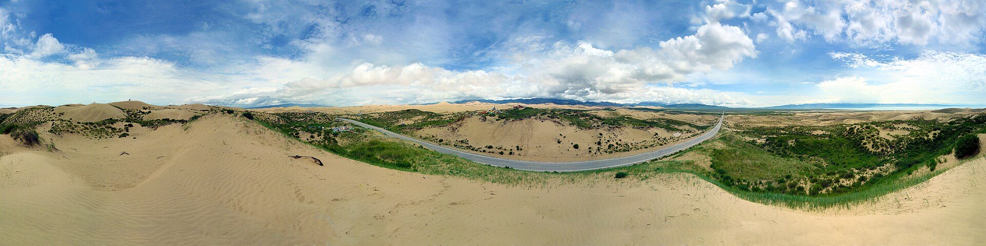
Five signature stops · In route order
The Grand Loop in Depth青甘大环线 · 五大必访之地
China's largest lake, two mirror salt lakes, the country's biggest salt flat and a black mountain that looks like the Moon — the five places that define the loop, with photos and video.
How to use this page
Five places, in the order you meet them
The stops below follow the loop clockwise from Xining: first the great lake, then the mirror salt lake, then deep into the Qaidam Basin for the salt flat, the black mountain and the emerald ponds. Each stop has a photo, a short video and the practical details that matter — best season and one tip worth knowing.
Two of the five sit off the standard route. Qarhan Salt Lake lies to the south near Golmud, and Heidu Mountain to the west near Lenghu — reaching all five means adding detours to the classic seven-day loop, and each one repays the extra driving.
About the videos: each clip is an animated still — a slow zoom into the photograph above it. They show the real places, photographed on site; no footage of a different place is passed off as the real thing.
Qinghai Lake 青海湖
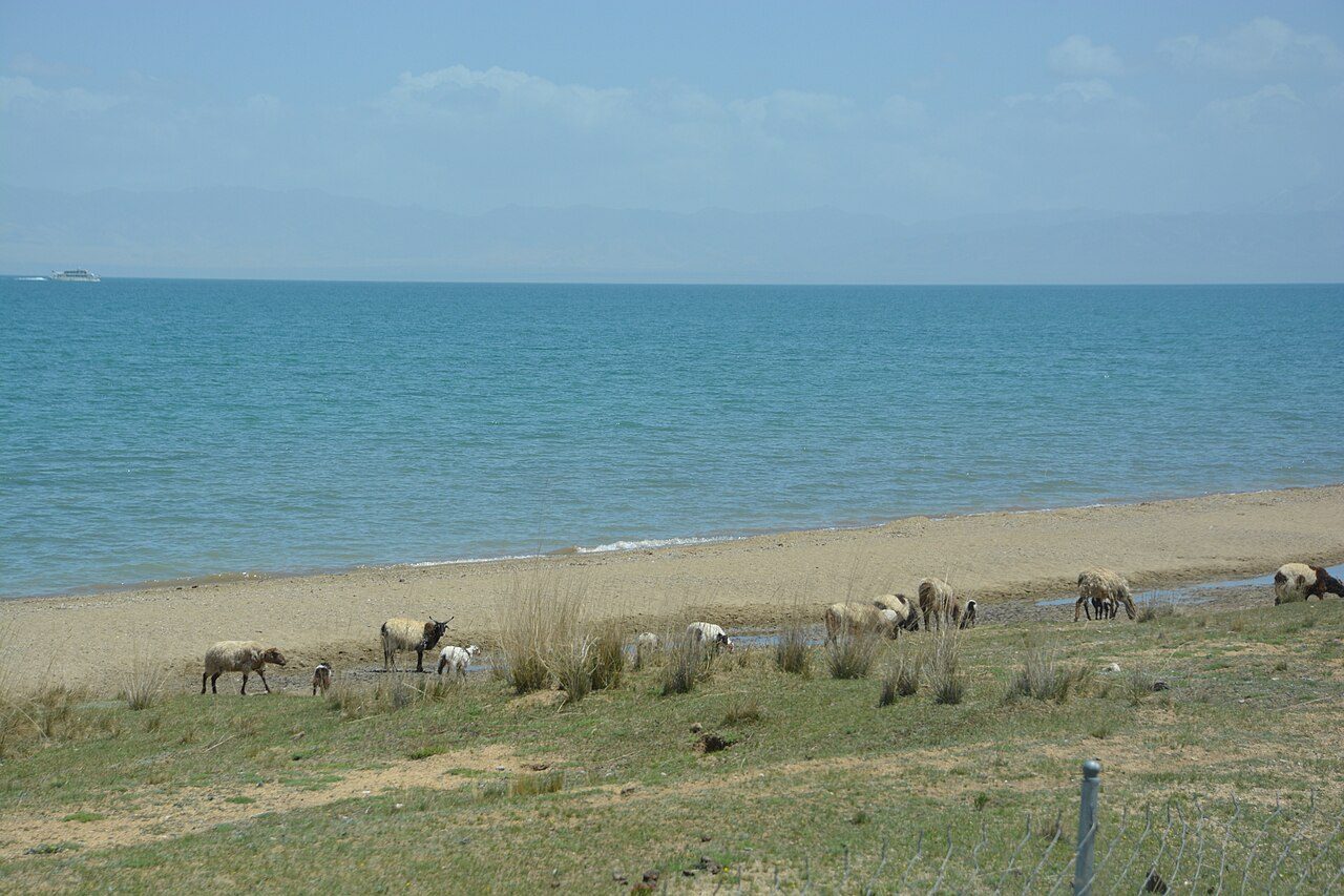
Qinghai Lake is China's largest lake — a vast saltwater sea on the northeastern edge of the Qinghai–Tibet Plateau, about 150 km west of Xining. On a clear day the water is an intense, almost unreal blue; when the wind drops, it turns glassy and mirrors the clouds and the snow peaks beyond.
The lake is ringed by grassland where Tibetan herders graze sheep and yaks, and in July the southern shore turns gold with rapeseed flowers. It is also a major stop for migratory birds. The classic experience is the sunrise at Heimahe on the western shore, where the sun climbs straight out of the water.
Chaka Salt Lake 茶卡盐湖
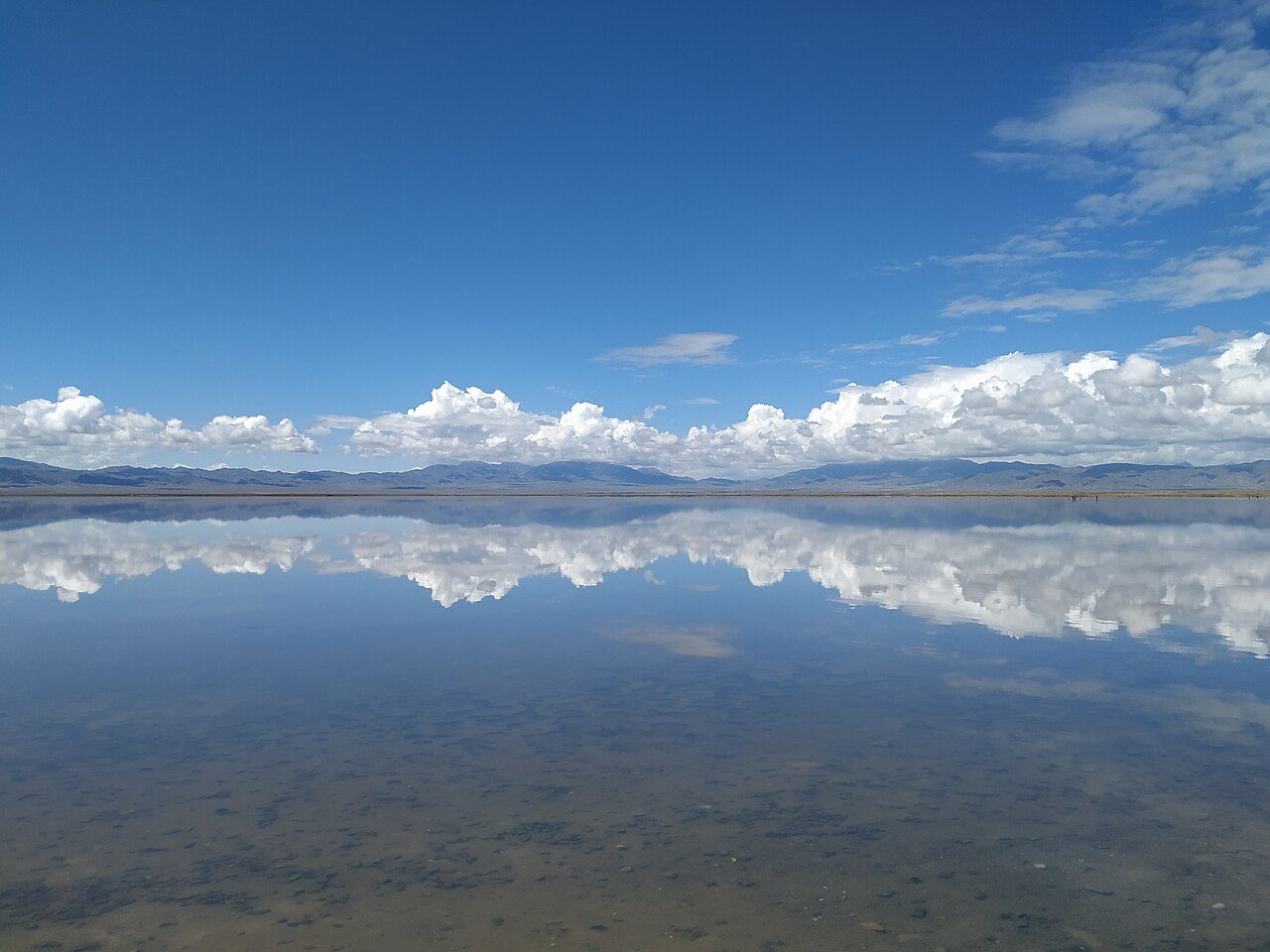
Chaka is the salt lake that made the loop famous. Across 105 km² of white salt crust, a thin sheet of brine turns the whole lake into a mirror — on a calm morning after rain, the sky, the clouds and the surrounding snow mountains reflect so perfectly that the horizon disappears and people look as if they are walking on the sky.
“Chaka” means “salt lake” in Tibetan, and salt has been harvested here for centuries — you can still watch workers raking salt the traditional way. A boardwalk leads out to the middle of the lake, where the reflections are at their best. Be aware the mirror is a natural phenomenon: it needs a thin layer of water and still air, so it is finest after rain and in the early morning, and it is not guaranteed every day.
Qarhan Salt Lake 察尔汗盐湖
Qarhan is salt on a scale that is hard to grasp: a salt flat of 5,856 km² — more than fifty times the size of Chaka — stretching over 160 km across the heart of the Qaidam Basin. Strictly speaking it is not one lake but a playa of many smaller salt lakes, the largest of them Dabusun Lake, divided by white salt crust 2–20 metres thick.
The lake is also one of China's great industrial landscapes: its brine holds potash, magnesium and lithium, mined here on a huge scale. Its most famous sight is the Wanzhang Salt Bridge (万丈盐桥) — a 32 km road built entirely of compacted salt, hard as asphalt, that crosses Dabusun Lake like a jade belt. The Qinghai–Tibet Railway runs across the salt flat on a salt roadbed too, with trains gliding over a white desert.
Heidu Mountain 黑独山
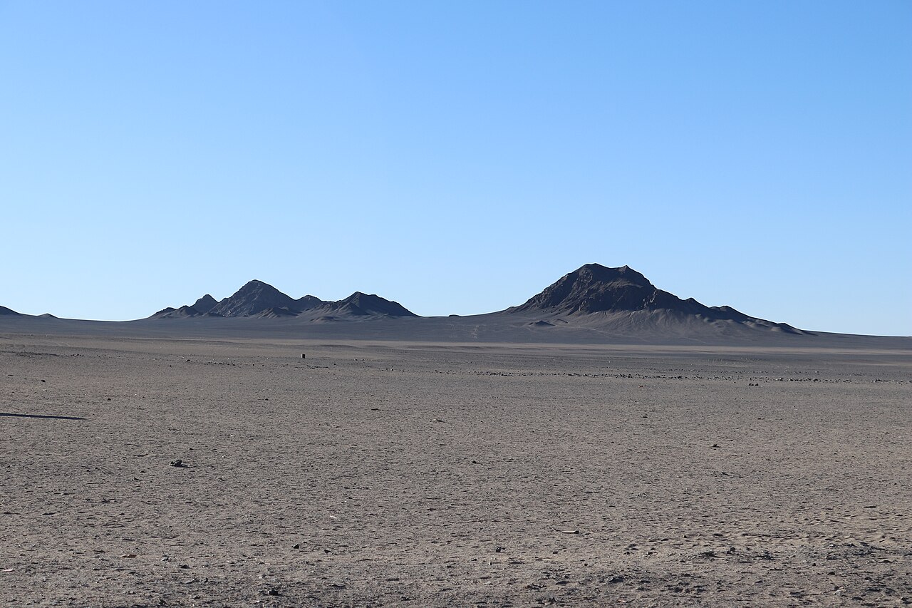
Heidu Mountain is the strangest sight on the loop: a lone mountain of ink-black rock rising out of a pale grey-white desert, a short drive from Lenghu Town in the far west of the Qaidam Basin. The black slopes are ancient volcanic rock coated in dark desert varnish, and against the white saline sand they look like a giant Chinese ink-wash painting — visitors call it the place on Earth that looks most like the Moon.
There is no grass, no trees and almost no sound — just wind-carved ridges, black gravel and an enormous empty sky. Just nearby, Rouge Mountain (胭脂山) offers the opposite extreme: soft pink-orange Danxia rock that glows at sunset, one black mountain and one pink one within a short walk of each other.
Heidu opened as a managed scenic area in May 2025: visitors take a shuttle from the entrance to the core area, then walk elevated boardwalks between viewing platforms. There is a visitor centre, restrooms and parking — but no restaurants and no lodging inside the park, so stay in Lenghu or Mangya. Stay on the boardwalks: the black gravel crust is so fragile that a single footprint can take ten years to recover.
Emerald Lake 翡翠湖
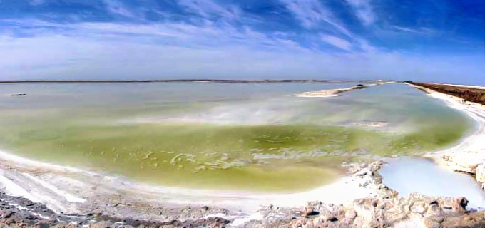
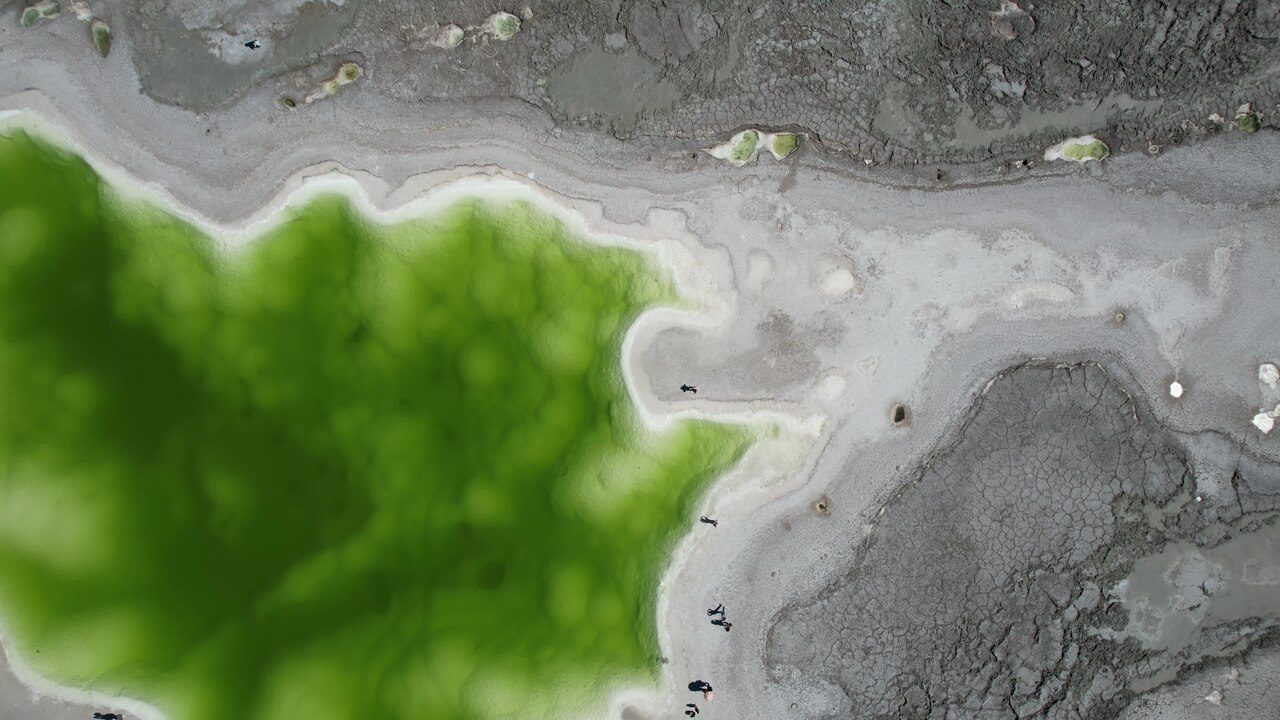
Emerald Lake is not a lake at all, but dozens of ponds left behind by a potash mine near Da Qaidam, about 11 km northwest of the town. When mining stopped, groundwater filled the pits — and the dissolved potassium, magnesium and lithium salts turned the water emerald green, turquoise and milky jade, each pond a different shade depending on its depth and minerals.
Seen from the salt ridges between the ponds, the colours shift with the sun: pale mint in the morning, deep emerald at midday. The white salt crust, the green water and the brown desert around it make one of the most photogenic scenes in the Qaidam Basin — an industrial site that nature quietly turned into a gem.
Keep planning
Put the five stops into your route
Qinghai Lake, Chaka and Emerald Lake sit on the classic seven-day loop; Qarhan and Heidu Mountain are detours that add driving days. See the full day-by-day plan and the practical information for international visitors on the main page.